
 / Supply Chain / Arctic Shipping
Arctic Shipping
Navigate high-latitude routes with clearer, more timely intelligence on vessels and ports with OCIANA®.

Arctic Operations Leave Little Margin for Error
Melting sea ice is opening routes that were once impassable, but the Arctic remains one of the most demanding operating environments at sea.
Shipping companies, ports and shore teams must plan around severe conditions, sparse infrastructure and incomplete information, often with only a narrow seasonal window to get it right.
Key challenges include:
- Extreme cold, storms and drifting ice can damage vessels and disrupt schedules, even in the summer season.
- Vast distances and few assets on station mean search and rescue and emergency support can be hours or days away.
- Limited nautical charts, navigational aids and communications coverage increase navigation risk and leave shore teams with an incomplete picture.
- Few deep-water ports, minimal infrastructure and narrow operating windows make arrival timing and port call readiness critical.
- Ice-class vessels are costly to build and operate, routes may depend on icebreaker support, and crews need specialist polar experience.
- Spills are harder to contain in ice, emissions and black carbon accelerate melting, and operators must meet Polar Code and evolving environmental requirements.
- Rising traffic affects Indigenous and coastal communities who depend on the marine environment for food, travel and annual resupply.

Why Arctic Shipping Matters
~40%
increase in vessel traffic in Arctic waters over 12 years
Up to 30%
162,000 km
Sources: Canadian Coast Guard Arctic Strategy; cited by the International Chamber of Shipping (2026).
Shorter Routes Between Markets
As sea ice retreats, northern routes are becoming a viable option between Asia, Europe and North America.
The Northern Sea Route can cut voyage distances by up to 30% compared with Suez or the Cape of Good Hope. That matters more as Red Sea diversions and drought-limited Panama Canal transits strain traditional corridors.
Shorter routes only pay off when operators can see what lies ahead. Maritime intelligence that combines vessel positions, ice, weather and route conditions turns a shorter route into a reliable one.
Lower Fuel Use and Emissions
Fewer nautical miles can mean lower fuel use and emissions intensity per voyage. Those gains are easily lost to an unexpected ice field, a weather delay or a long wait outside a constrained northern port.
Predictive ETAs and early alerts help operators adjust speed and timing before problems build up, so shorter voyages deliver real fuel and emissions savings.
Independent data on vessel activity also supports emissions reporting and Polar Code compliance.
Lifeline for Northern Communities
For many Arctic communities, the annual sealift is the main supply line for fuel, food, building materials and essential cargo. Most of these communities sit on the coast and depend on a short summer shipping season, so a delayed voyage can affect them for months.
Shared maritime intelligence gives operators, ports and community partners the same up-to-date view of vessel progress and arrival times, so they can plan resupply and react early when conditions change.
Resource and Economic Development
Fishing, mining, energy projects and tourism are expected to bring more vessels into Arctic waters, making these waters a growing maritime economic artery.
More traffic means more vessels to track, more port calls to coordinate and more pressure on limited infrastructure.
Maritime intelligence helps ports and operators handle that growth: anticipating arrivals, sequencing port calls and spotting congestion or risk before it slows operations.
.
Presence and Sovereignty
The Arctic covers vast stretches of remote coastline and open water. In Canada alone, that means about 162,000 km of coastline, more than 60% of the national total. Patrol assets and communications coverage can’t be everywhere.
Persistent maritime domain awareness shows which vessels are operating, where they’re heading and whether their behaviour is unusual.
That supports national presence, maritime security and the protection of northern interests as new routes and operators appear.
OCIANA®: Designed for High-Latitude Operations
OCIANA® fuses vessel, voyage, ice, weather and port data with proprietary maritime algorithms and predictive AI to give operators and their partners a clear, real-time operational picture across the Arctic maritime domain.
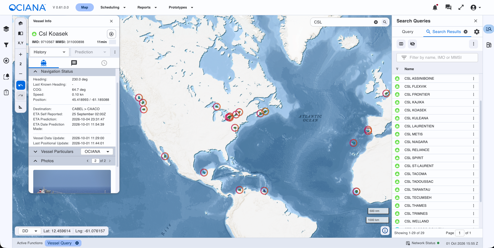
Arctic Maritime Domain Awareness
Maintain a persistent view of vessel activity across remote Arctic waters, combining multiple data sources to fill gaps where traditional coverage and connectivity are limited.
Predictive ETA in Changing Ice and Weather
Forecast arrivals and receive early alerts when ice, weather and route conditions shift so teams can adapt voyage plans within narrow operating windows.
Sealift and Northern Port Call Readiness
Coordinate resupply voyages and port calls at constrained northern ports, aligning vessel arrivals with berth, cargo and community readiness.
Risk and Anomaly Detection
Highlight unusual vessel behaviour, deviations and exceptions that need attention, helping shore teams identify and respond to emerging safety and security risks early.
Emissions and Environmental Monitoring
Monitor emissions and vessel activity in sensitive Arctic areas to support Polar Code compliance, environmental reporting and response planning.
Shared, Data-Driven Decisions
Give operators, ports, coast guards and partners secure, role-based access to the same intelligence, via web interface or API, to support joint, data-driven decisions.
Explore Smarter Arctic Operations
See how OCIANA® gives you a clearer, more timely view of vessels, routes and operating conditions across the Arctic.
 English